Epona 100 Ultra - 2024 Recce Routes
The EPONA 100 Mile route broken up into scouting routes

Note: These routes are for the 2024 version of the race. Both the 2025 and 2026 versions have a very different route.
The Epona 100 Ultra is the first 100 miler Pegasus has launched, sitting alongside their shorter (but utterly brilliant) routes around South West Wales, and the multi-day hardcore Wild Horse 200 miler.
I've taken it on in 2024 as my first 100 miler; and to be honest reading up about what it entails I am BRICKING IT.
It contains 5,400 meters elevation gain over 23 mountains, namely Sugar Loaf, Skirrid Fawr, The Blorenge, Gilwern Hill, Blaen Onneu, Mynydd Llangynidr, Pant y Creigiau, Bryn Melyn, Tor y Foel, Table Mountain, Pen Cerrig Calch, Pen Allt Mawr, Pen Tywn Glas, Mynydd Llysiau, Pen Trumau, Waun Fach, Pen Y Gadair Fawr, Rhos Dirion, Twmpa, Hay Bluff, Twyn Llech, Black Mountain, Sugar Loaf for a second time (because why not!)
To help out I'm planning to do lots of recces of the route and long trips out to the mountains where I can practise hard climbs.
I'm sure plenty other Epona runners will be looking to do the same, so in case it helps here's some GPS files splitting the route into 5 stages.
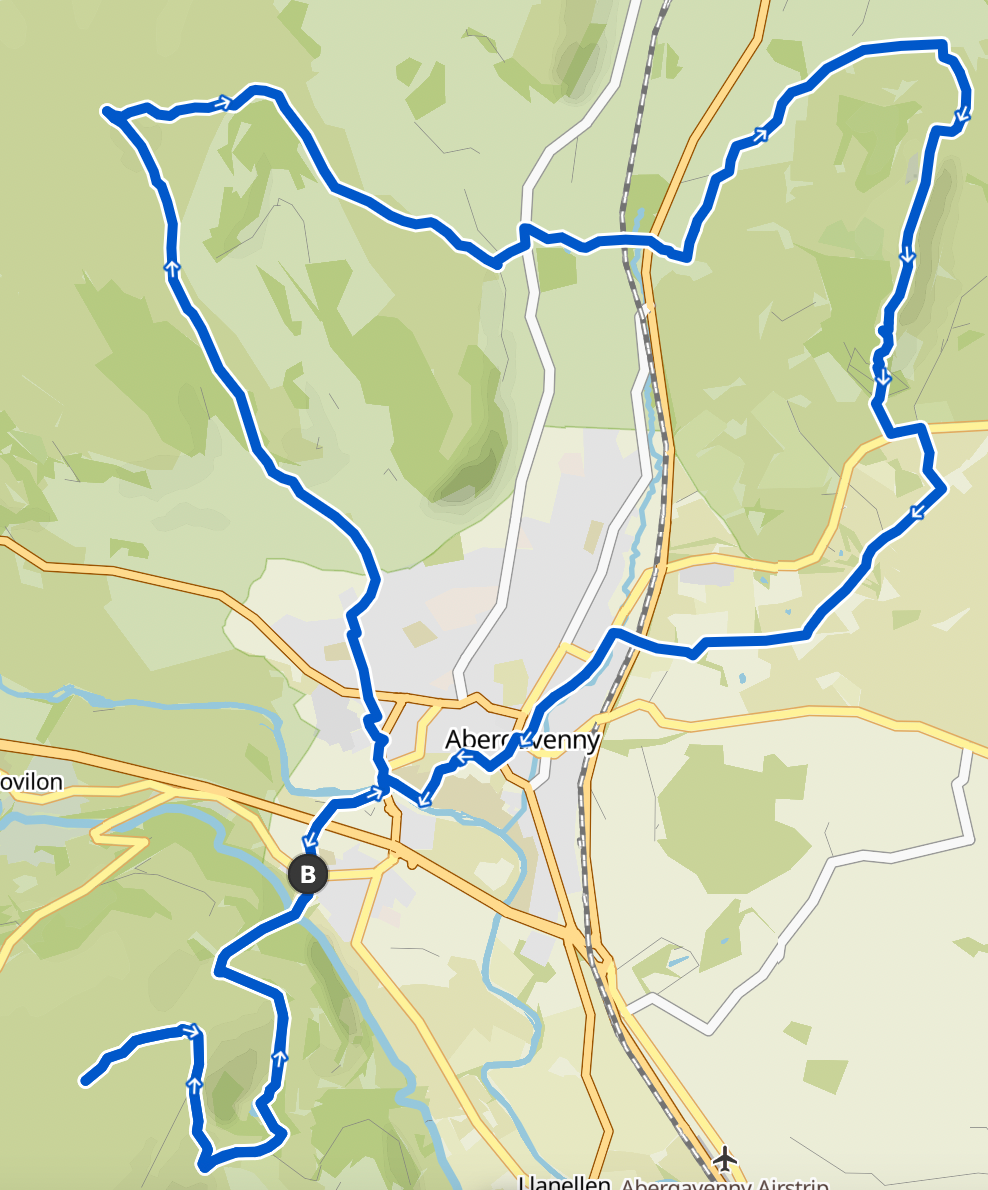
Stage 1: Three Sisters
Sugar Loaf, Skirrid Fawn & The Blorenge. Starting at a car park in Llanfoist with easy access to this stage. Comes in at 35k with 1,460m vert
GPX File:
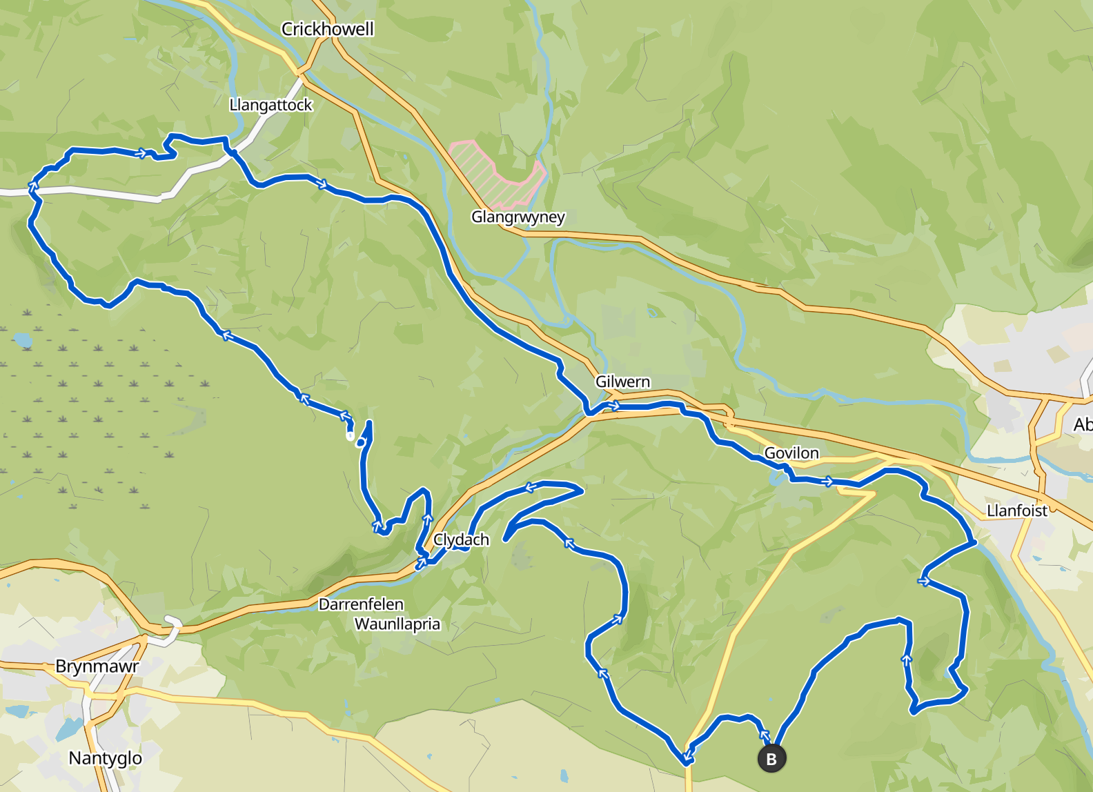
Stage 2: Passing Clydach
Stretch connecting The Blorenge to the Beacons north west, 36k, 900m vert
Start point is the car park on the shoulder of The Blorenge
GPX File:
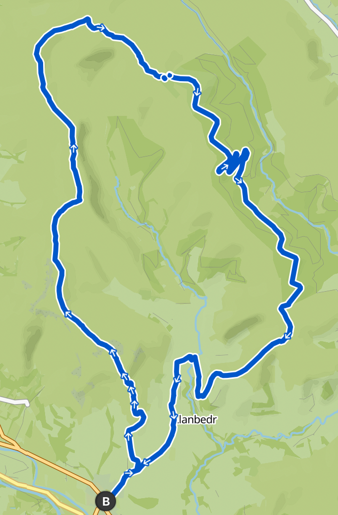
Stage 3: Beacons
39k, 890m vert, starting at Llangattock where they looks to be plenty of parking.
Doing a loop of the Beacons stretch
GPX File:
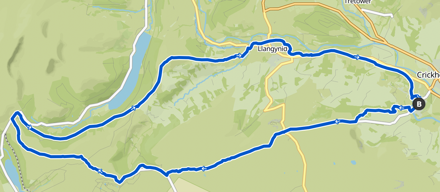
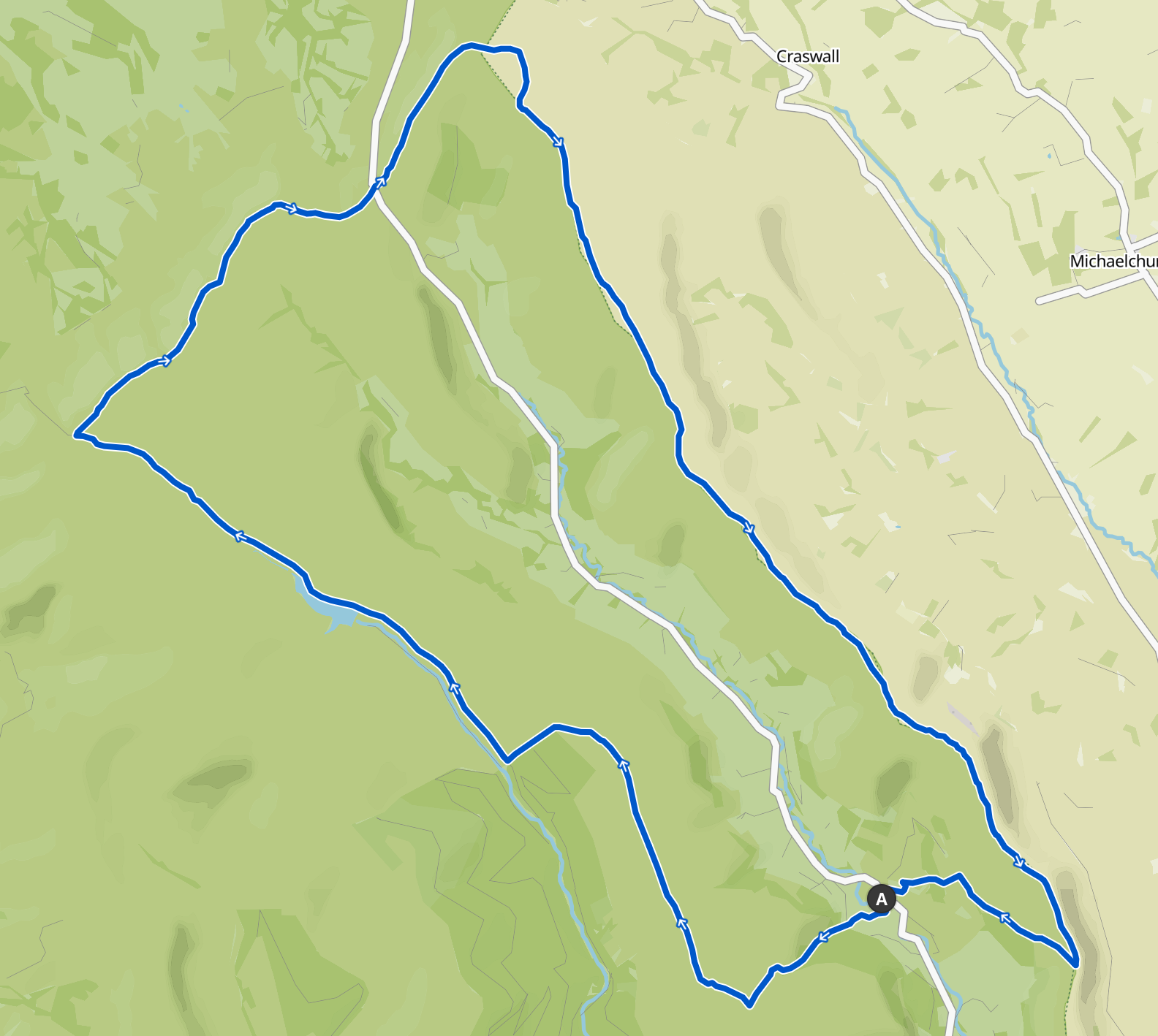
Stage 4: Black Mountains Horseshoe
Starting in Crickhowell, takes in the first half of the Black Mountains section as a long horseshoe. Definitely one to do on a clear day as it is gorgeous.
36km, 1,150m vert
At the start point on the route there is usually a few spaces to park up. There is also a larger paid public car park in Crickhowell too.
GPX File:
Stage 5: Llanthony Loop
The final recce starts in Llanthony and goes along the second half of the Black Mountains.
35km, 920m vert
Llanthony is a popular starting point I've heard with parking available.
This route is a total unknown to me, I've never ran the area north east of Waun Fach so looking forward to checking it out.
GPX File:
Missing Pieces
After the 5th stage there is a connection from Llanthony south back to Sugar Loaf which these recces don't cover.