Wotton to the Tyndale Monument - Friday Route Recommendation
Scenic 8k run in the woodlands north of Wotton-under-Edge

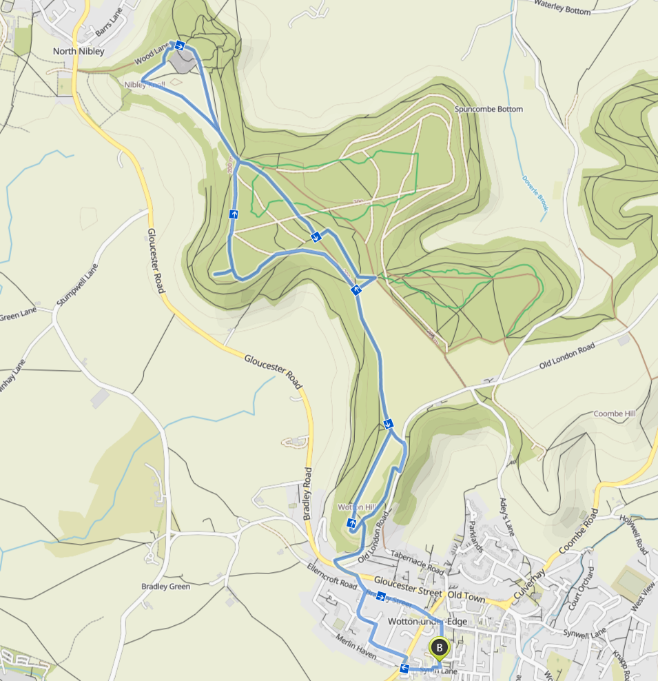
Distance: 8km
Elevation Gain: 184m
Type: Trail
Route Link: Komoot | Strava
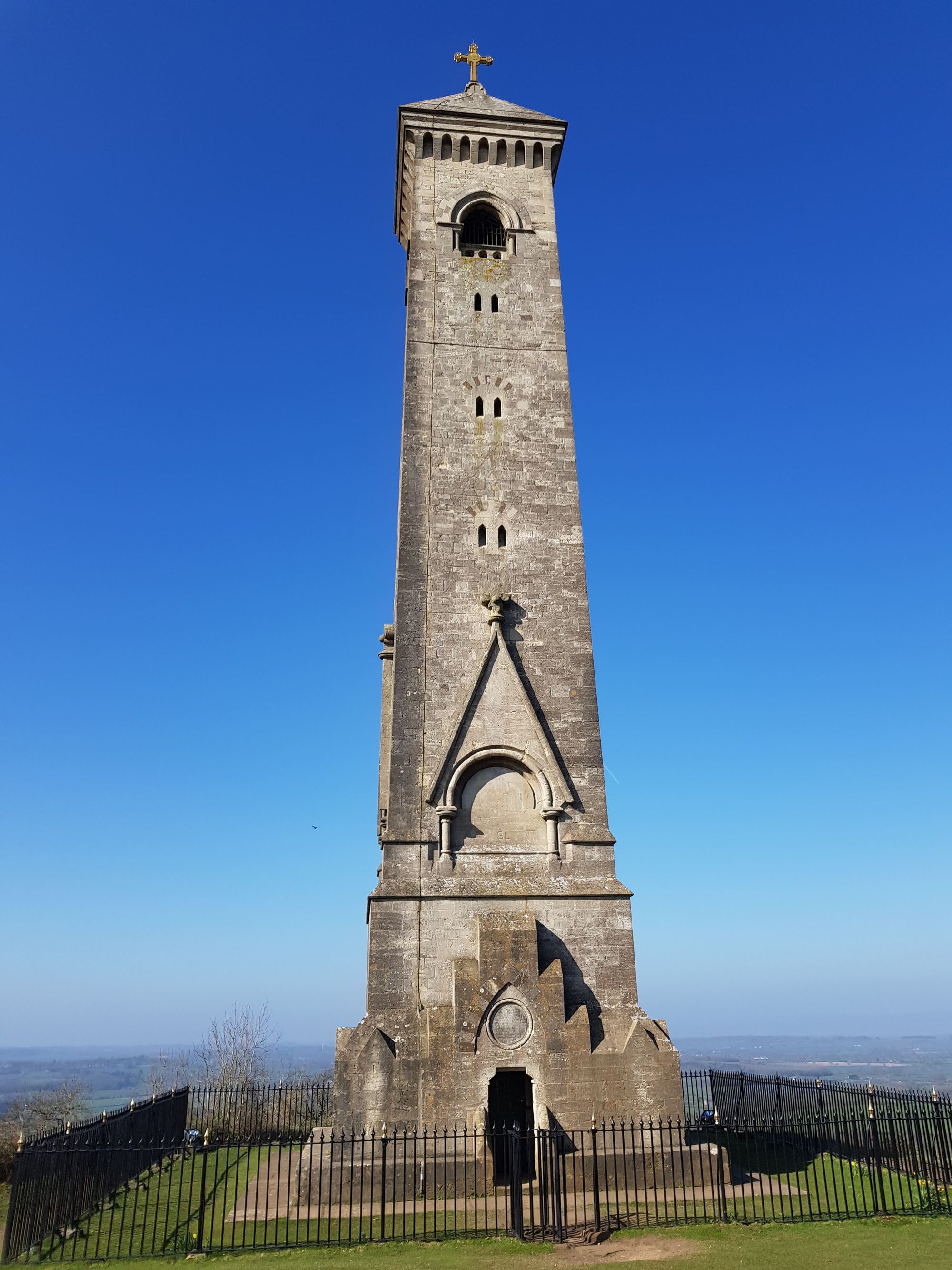
Forming part of the Cotswold Way; the woods north of Wotton-under-Edge make for some excellent running, with plenty of views to boot and a half way point reaching the William Tyndale Monument.
The route starts in the heart of Wotton in the town car park, then proceeds through a bit of the town before the trail starts.
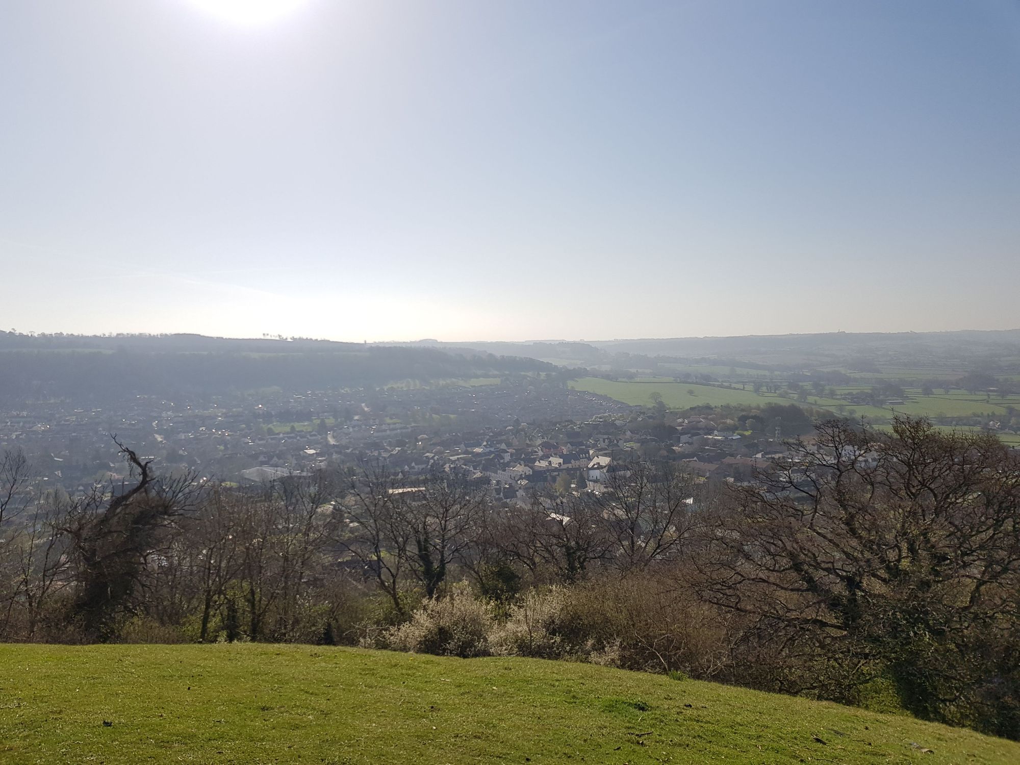
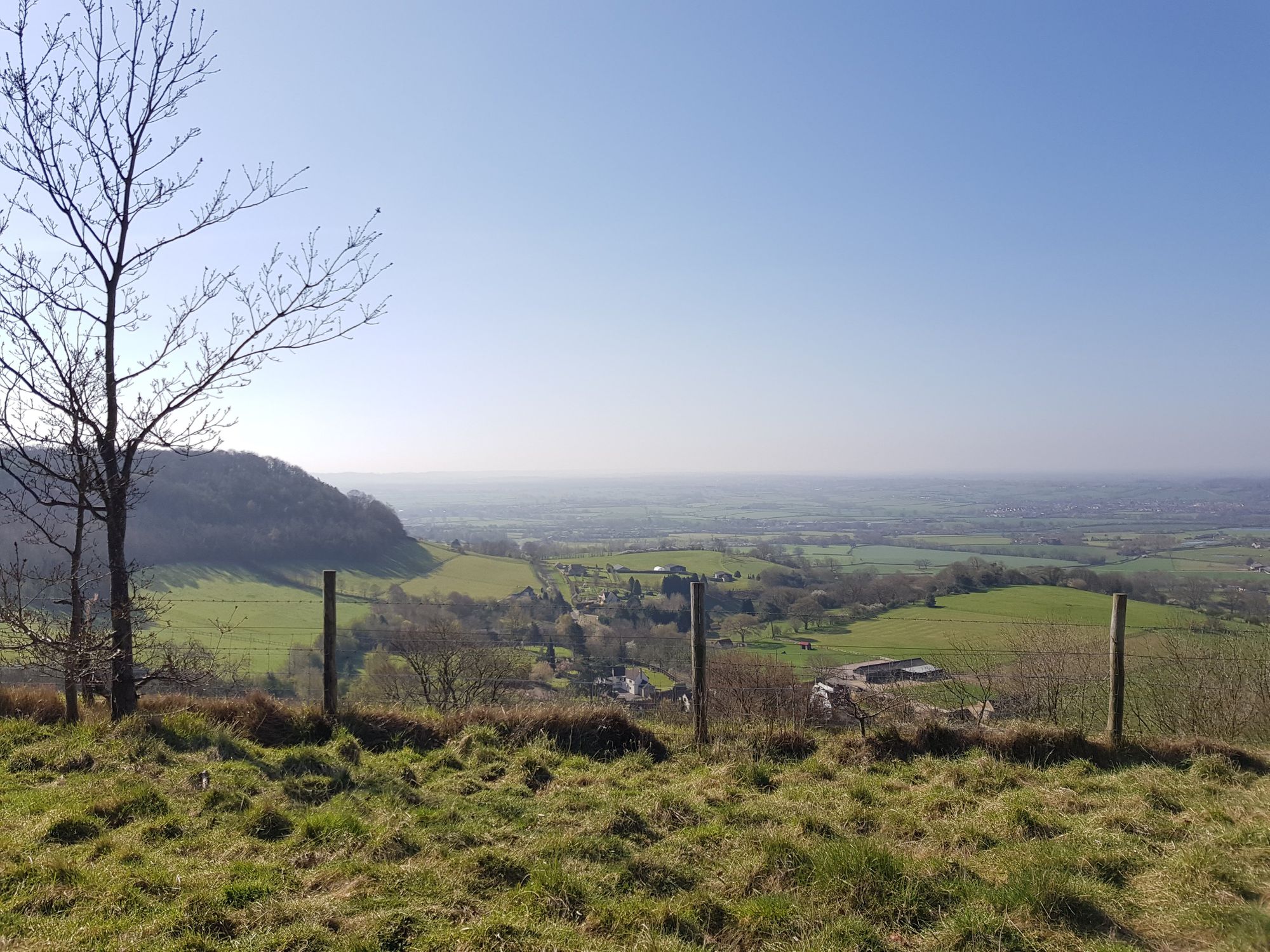
The trail begins with an arduous climb that peaks at Wotton Hill where you'll find views over South Gloucestershire and a ring of planted trees on the hill, both make it worth the elevation!
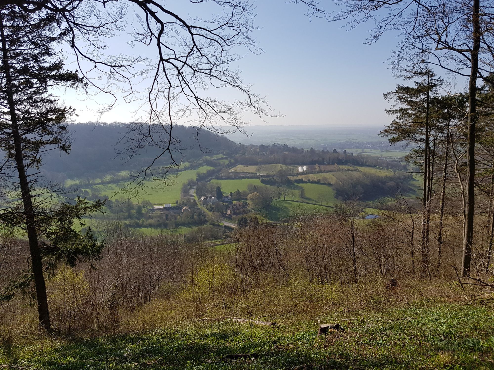
After that the trail leads into the woodlands which run high above the fields below, offering views as the trees part.
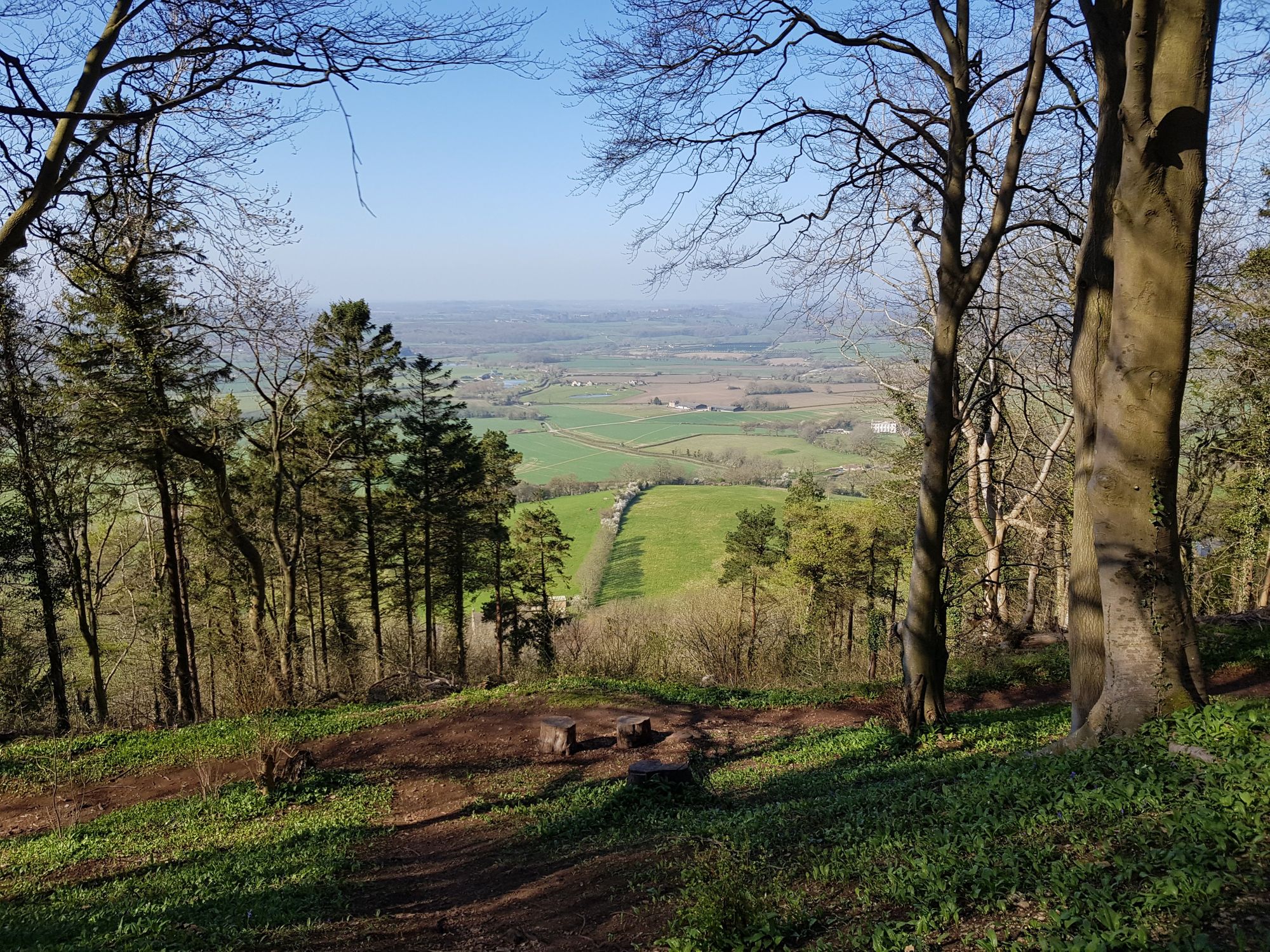
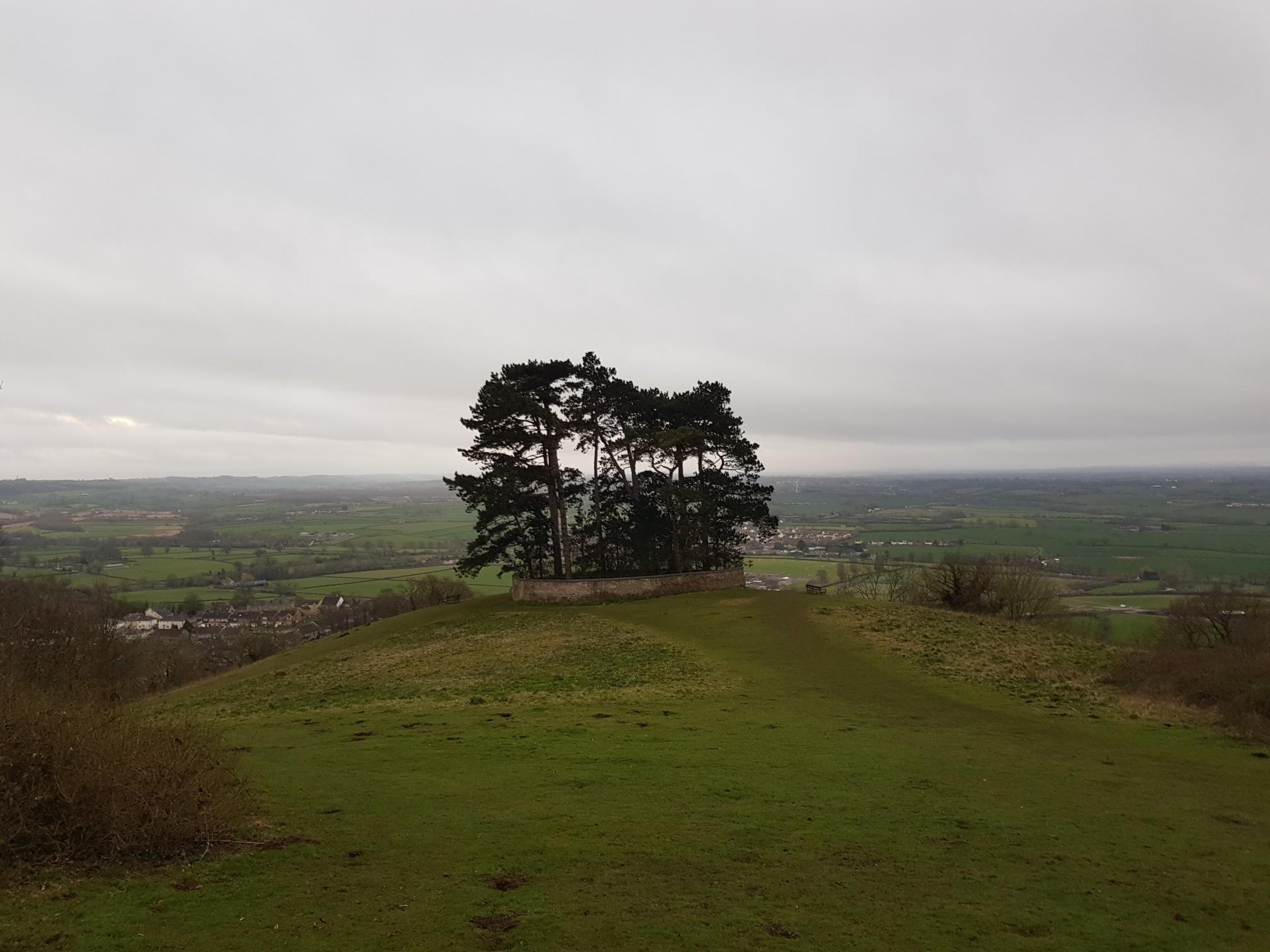
Then the woods give way to the hill on which the Tyndale Monument sits, making a good place for a breather / picnic / energy gel.
On the return the route takes you a different way through some thicker woodland before hitting Wotton Hill again for the descent into the village.