Epona 100 - 2026 Recce Routes
The EPONA 100 Mile route broken up into scouting routes

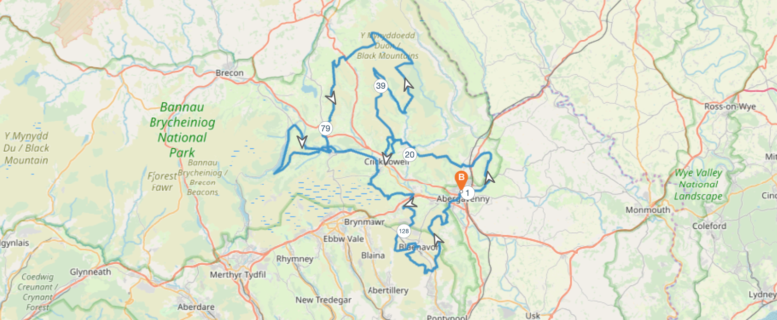
For 2026 the Epona 100 has a vastly different route from the preview two years, which keeps things fresh and lets us explore some new areas of the mountains.
For those who have done the race before, the most notable changes are:
- Immediately going up Skirrid Fawr then over to Sugar Loaf
- Only ascending Sugar Loaf once this time around
- Instead ascending Table Mountain twice
- Twmpa, Hay Buff & the long ridge down to Llanthony are gone
- We go off the Black Mountains over Mynydd Troed instead
- By far the biggest change
- Over Mynydd Llangorse through Bwlch to Llangynidr
- Back up to Tor y Foel, the Talybont Reservoir then onto the canals to Llangattock
- From Llangattock to the Lonely Shepherd, down to Gilwern then up to the old route above Clydach
- Long way down to Blaenavon instead of cutting across, before going back up to the Blorenge
- Another large change, with tricky navigation
- Blorenge is the final summit before ascending back to Abergavenny
Below I've split the route into a series of recce loops for folks who may want to get familiar with the trails before the big day.
There are some gaps in the recces, I've listed them at the start of each section where relevant.
#1 - Skirrid and Sugar
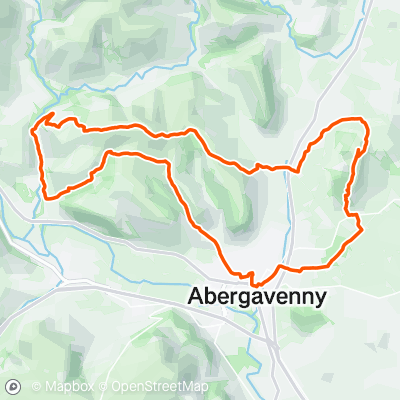
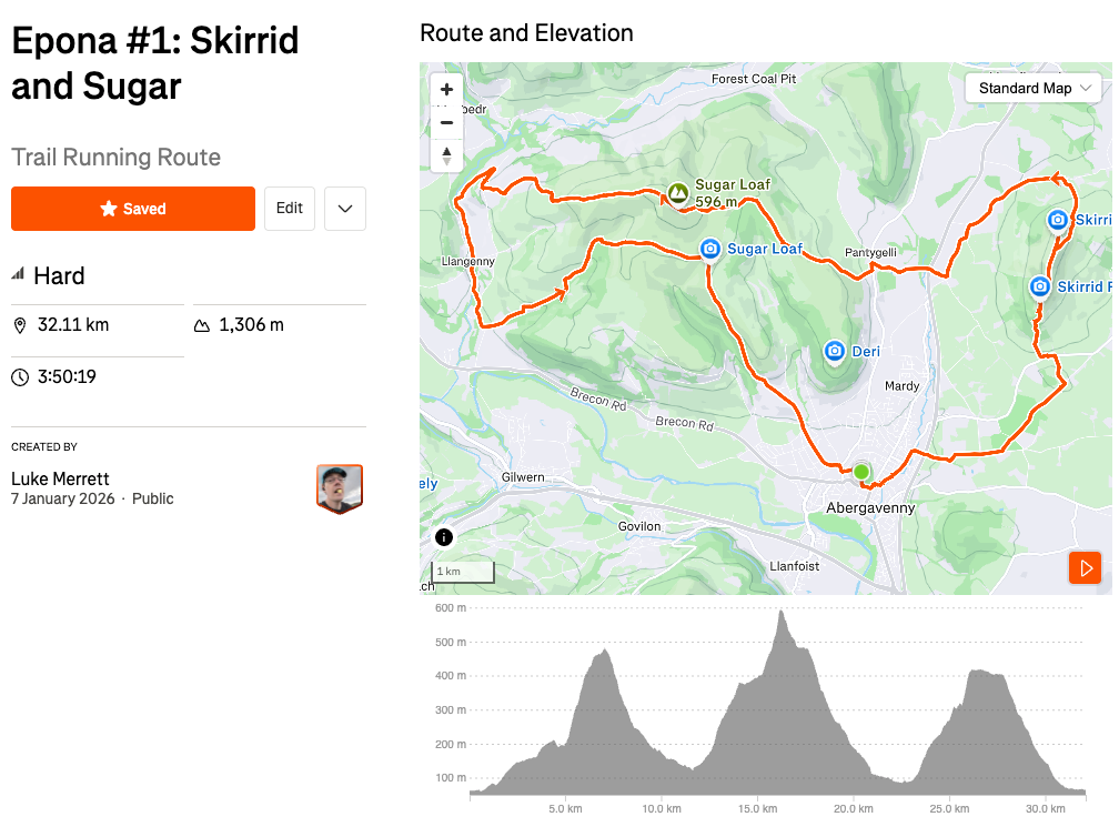
Parking: Large paid car park next to Bailey Park
#2 - Two Tables
Gap: Small woodland section after Sugarloaf to connect to the start point in Llanbedr
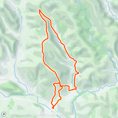
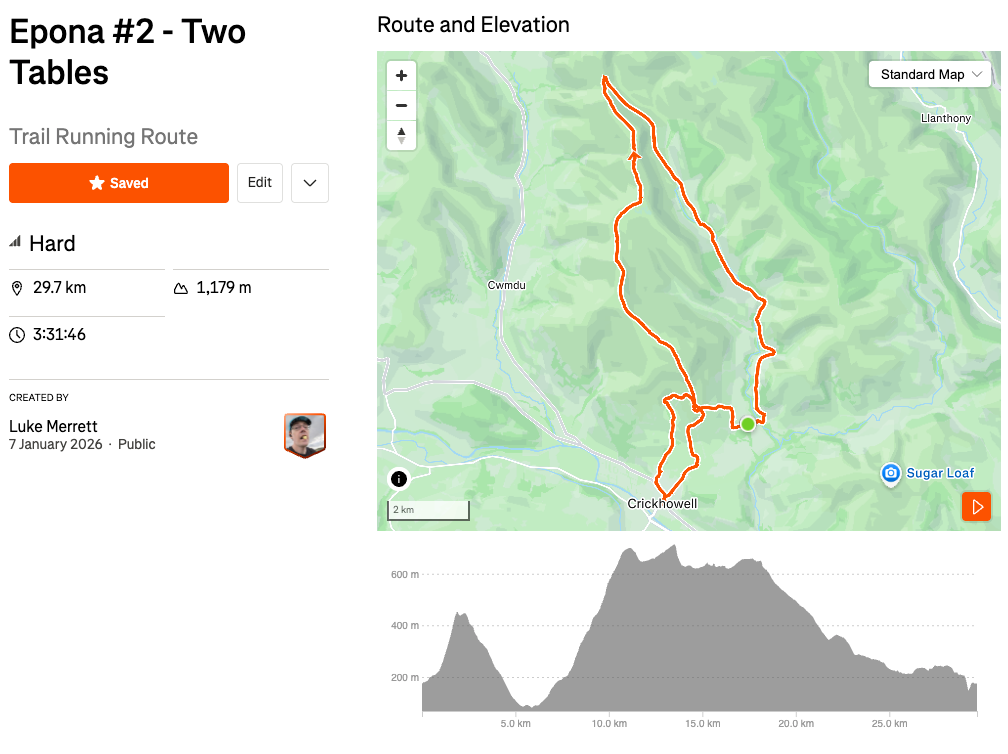
Parking: Limited residential parking in Llanbedr. If doing as a group I'd recommend parking in Crickhowell instead (Llanbedr Road outside The Swan Inn has free residential parking and is on route)
#3 - Black to Mynydd
Gap: From the valley with the Grwyne Fechan river up to Pen Twyn Mawr. We do go down the same descent off Pen Y Gadair Fawr at the end though
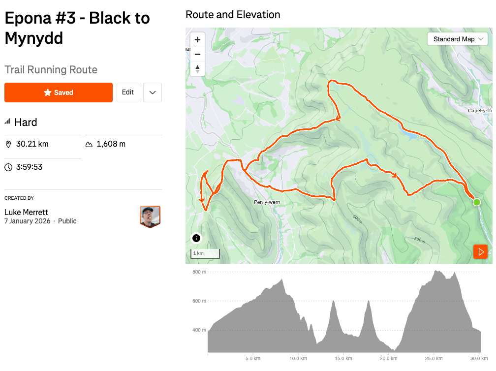
Parking: Free car park at start point, fairly narrow road leading to it mind. There's also the Grwyne Fawr bothy on the north west tip of the reservoir if you're feeling especially brave and fancy a night sleeping in the mountains.
#4 - Tor y Foel and Talybont
Gap: Bottom of Mynydd Troed at the southern road up along the Mynydd Llangorse ridge to Bwlch and into Llangynidr.
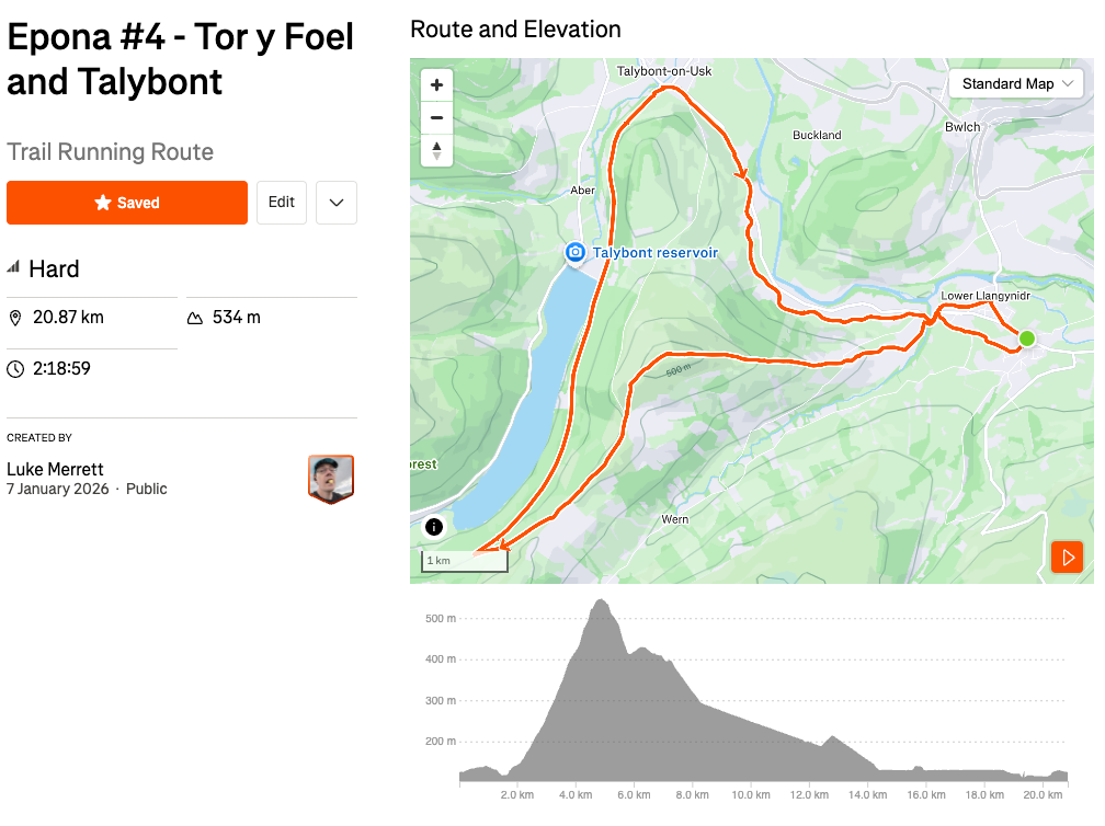
Parking: Large free car park in Llangynidr at start point
#5 Llangattock to Gilwern
Gap: Whole canal section from Llangynidr to Llangattock
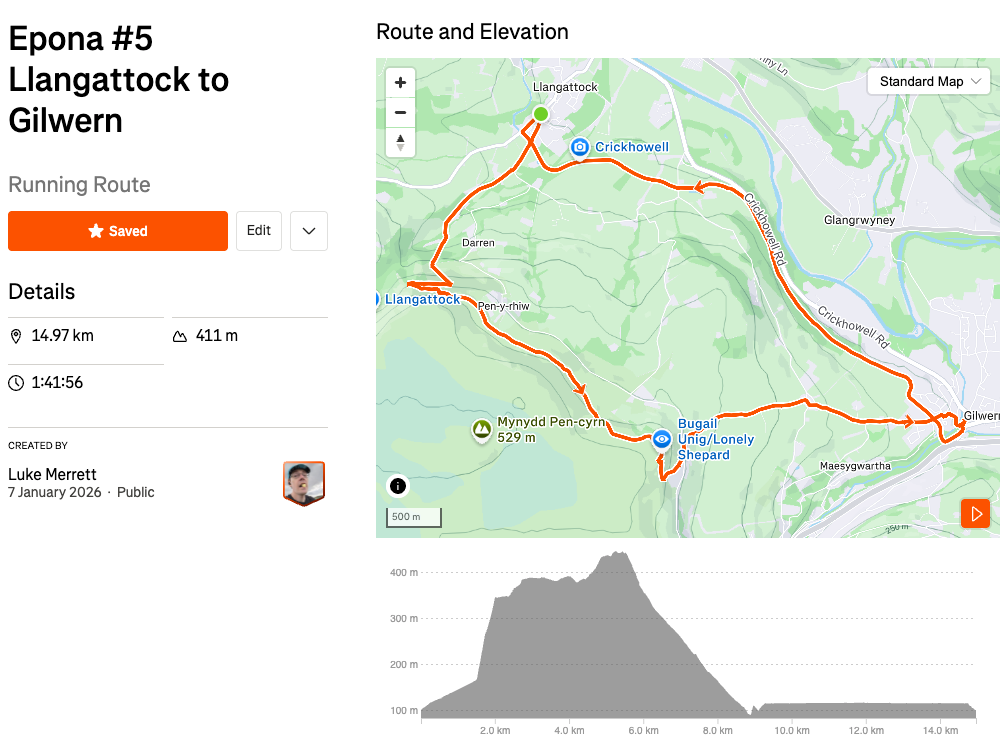
Parking: Free residential parking along Hillside Road
#6 Gilwern to Llanfoist
Note: This is the section I would most recommend reccing, it has off trail sections and the Strava Heat Map for most of the section around Blaenavon is weak, indicating infrequently used trails. It's also towards the end of the race where your brain will likely be fried from fatigue.
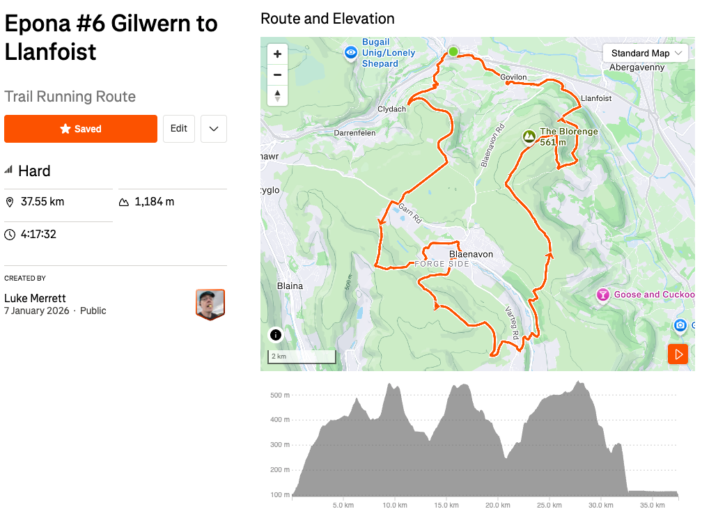
Parking: Free small car park at start point, residential parking behind it to the north if full
Gap: Llanfoist to the finish line in Bailey Park, Abergavenny 🙂